
Who Lives Along a Fremont Street?
A Fremont street directory works as a chain, not a single resident list. Begin with a normalized USPS address and locate the parcel in the Alameda Assessor or Fremont eGIS viewer. Carry the APN into the property and recorder work, then use city permits and historical street sources for context. This order separates land from people. It can identify an owner, a recorded party, a permit applicant, or a historical listing, but it cannot reliably enumerate every household member at a parcel.
The county parcel tools are address-first. The recorder is party-name indexed. Reverse directories are edition-specific. Voter information is restricted by purpose and authentication. A strong street directory search keeps each result tied to a date, address role, and source rather than turning several weak clues into a claim about who lives there.
- Enter the normalized address in the Alameda Assessor Parcel Viewer or select the parcel on a map, then record the APN and situs.
- Open Fremont eGIS, turn on parcel and address layers, and inspect the target lot and nearby polygons one at a time.
- Use the APN, legal description, and current assessment name to locate a matching deed in the Alameda County recorder index.
- Check voter information only through an authenticated self-check or an approved geographic file request, never as open street browsing.
- Search a reverse or criss-cross directory under the right predecessor town, then compare street order with the alphabetical entry and adjacent numbers.
Note: An address can anchor a record trail without proving that the named owner, applicant, or historical listing is the current occupant.
Turn a Fremont Address into an APN
The Alameda County Assessor Parcel Viewer offers three documented routes: APN, site address, and interactive map selection. The site address is the situs, meaning the physical place assessed as land. It is not necessarily the mailing address used for a tax bill or owner correspondence. Start with the street number and name, and leave off a unit when a multiunit result does not match at first.
The parcel card or map can provide APN, situs address, tax-rate area, use description, assessed land and improvement values, total value, assessment year, and parcel geometry. The public interface does not provide a general owner-name search. If a mailing owner or addressee is visible through a tax-roll context, treat it as an ownership or forwarding clue. It is not a public list of the people inside the parcel.
| Assessor field | Type | Required route | Format or use note |
|---|---|---|---|
| APN | Text | One route | Use the displayed grouped digits and do not guess leading zeros. |
| Site Address | Text or autocomplete | One route | Search the situs, not an owner mailing address; omit the unit first if needed. |
| Map | Interactive selection | One route | Pan, zoom, and click a parcel when address matching is uncertain. |
| Search / Clear | Buttons | Query or reset | Run the search or return to a blank form. |
Carry the APN into the Alameda property-tax service and then into the recorded-document workflow. The APN connects the map to the county's land identity, while the legal description in a deed controls the transfer. For a full Fremont street directory search, preserve the exact address string and the APN together so later name matches can be checked against the same parcel.
Browse Fremont Street Blocks in eGIS
Fremont eGIS is the street-browse layer of the Fremont street directory workflow. Search an address, select the candidate, zoom to the parcel, activate parcels or address layers if needed, and click the polygon for attributes. Close that pop-up before clicking each touching parcel. Pan along the same block face, switch between street and aerial basemaps, and keep a short APN-to-situs log.
The viewer can show streets, addresses, parcel outlines, zoning, land use, neighborhoods, council districts, and other published layers. Identify or select tools return attributes for the feature under the cursor. Measure, print, and share tools can preserve the map extent when enabled. The map is reference data. Boundary or title questions belong with the county, recorder, or survey source rather than a visual parcel edge.
The county parcel viewer is a useful cross-check. When the city map and county card appear to disagree, compare the APN, legal description, subdivision, lot and block, and map date. A large apartment parcel may show one situs with no unit-level public list. A condominium address may contain several APNs at one street number.
The Fremont eGIS parcel viewer shows how an address can be extended to nearby lots.
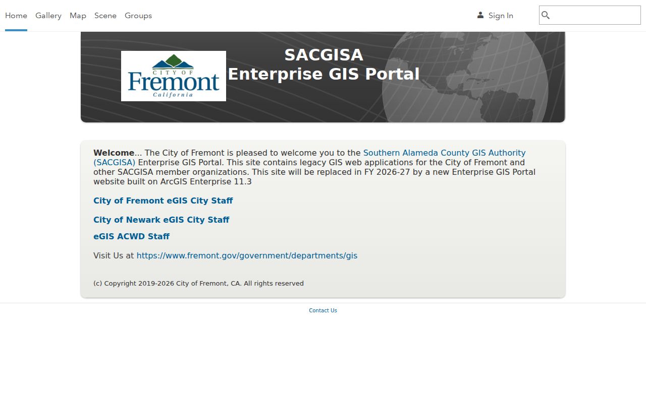
The parcel view supports a careful block inventory of land and map context. It does not convert adjacent polygons into a list of Fremont residents.
Fremont Records Searchable by Street
Several Fremont records can be reached from a street address, but each has a different keeper and proof value. The address is usually the first key for the assessor, GIS, permits, and USPS. The APN or legal description becomes the bridge to a deed. A historic street guide may take the reverse path from house number to a listed occupant. The voter file is the exception: a geographic request requires an approved purpose, and the self-service form authenticates the voter rather than exposing a street roster.
| Address-keyed source | Custodian | Street-level evidence | How to reach it |
|---|---|---|---|
| Assessment parcel | Alameda Assessor | APN, situs, value, use, and tax geography | Free address, APN, or map search |
| Fremont eGIS | Fremont GIS | Parcels, streets, addresses, zoning, and districts | Free interactive viewer and map layers |
| Recorded instruments | Alameda Clerk-Recorder | Grantor, grantee, date, type, and legal transfer trail | Online party index from 1969; older counter research |
| City permits | Fremont Community Development | Project, applicant or owner contact, dates, status, and inspections | Citizen Access and Self-Help Center; 1956 archive guidance |
| AgencyCounter activity | Fremont Planning | Mapped development applications and area activity | Free map, summaries, and alerts |
| Reverse directory | Library or museum holdings | Listed occupant, phone, and neighboring house numbers for an edition | Research editions under the correct old town |
| Voter information | California and Alameda election offices | Only approved, purpose-limited geographic data | Authenticated status or qualified file process |
The table shows why a Fremont street directory is a research sequence. A parcel result can point to a deed. A deed can point to a prior owner. A permit can date a physical change. A reverse directory can offer a period occupant. None of these sources should be presented as a complete, current household roll.
Note: The same street address may appear in an assessment record, a permit, a deed, and a directory while referring to different people and different years.
Trace Fremont Street Deeds after 1969
The Alameda County Official Public Records index is searchable by party name and can be narrowed by recording date and document type. Relevant categories include deeds, deeds of trust, reconveyances, liens, releases, judgments, easements, maps, and notices. Start with a verified assessment name or a known party, then compare the parcel's legal description and subdivision details. A party-name hit alone can concern another property or another person with the same name.
The electronic index covers 1969 to the present. For older Fremont streets, the Clerk-Recorder's Oakland office at 1106 Madison Street is the route to in-person grantor-grantee research, with county official records reaching back to 1853. A Dublin satellite office is at 7600 Dublin Boulevard, Suite 160. Plain recorded documents cost $3.50 per page; a certified copy adds $1 to the first page. Online orders add a $2 convenience fee, and mailed orders are stated to take 5 to 10 business days when the locator and payment are complete.
The Alameda Official Public Records search explains the party-index starting point.
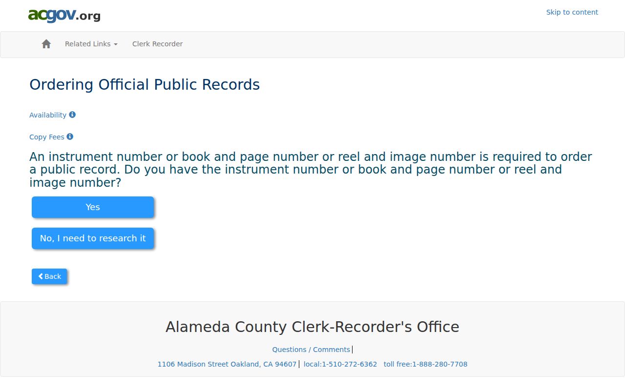
The deed-index screen reinforces the key limitation: a recorder copy order needs an instrument number, book and page, or reel and image. The free search or counter step must come before the paid copy request.
- Use the assessor or eGIS result to note APN, current assessment name if visible, subdivision, and legal-description clues.
- Search the name in the recorder index and narrow by deed type and date around the likely acquisition.
- Read the grantor and grantee roles, then match the legal description and cross-references to the same parcel.
- Search the prior grantor as an earlier grantee and repeat until the online cutoff requires Oakland counter research.
A deed chain tracks recorded ownership, not occupancy. Trust instruments secure financing, reconveyances release that security, and permits may name an applicant rather than a person living at the site.
Fremont Street Permits from 1956 Forward
Fremont's incorporation date supplies a practical starting line for city permit research. In Citizen Access, choose Search Records, select Building or the relevant planning, fire, or engineering family, enter a street number and name, and use a Start Date of 01/01/1956 for the full city archive guidance. Record Type, Record Number, date range, Street No., Street Name, and Parcel Number can narrow the search. Results may show description, status, applied and issued dates, inspections, contacts where public, and selected documents.
The public search does not require an application account. The Permit Self-Help Center at 39550 Liberty Street has public computers. Walk-ins run Monday through Thursday from 8:00 a.m. to 3:30 p.m., with a noon to 1:00 p.m. closure, and Friday from 8:00 a.m. to noon. Digital copies are free. Paper letter-size copies are typically $0.25 for the first five pages and $0.10 for each later page. Plans prepared by a licensed professional need written consent from that professional and the original or current owner under Health and Safety Code section 19851.
AgencyCounter maps active construction and development applications, provides daily-updated summaries, and allows area email alerts. Fremont Engineering can provide tract maps, parcel maps, aerial photographs, street-improvement plans, flood-zone material, elevation certificates, and construction drawings by phone or email. Its listed contact is 510-494-4700 and engineering@fremont.gov.
Permit history is useful for dating an addition, demolition, reroofing, or subdivision change. It is not a resident list. An owner name can be an applicant or contact, and a permit date can show a physical project without showing when any person moved.
Note: A 1956 permit search follows Fremont's incorporated-city archive and should not be treated as a complete pre-incorporation street history.
The 1956 and 1969 Fremont Street Cutoffs
Two dates shape a Fremont street directory more than a modern search box suggests. January 23, 1956 is the incorporation boundary for city permits and administrative files. 1969 is the start of the Clerk-Recorder's electronic party index. Alameda County's recorded series begins in 1853, so the gap before 1969 is an access change, not an absence of deeds.
- 1853 - County deed and related record books begin under Alameda County.
- 1956 - Fremont joins five older communities and begins its city permit archive from incorporation forward.
- 1969 - Electronic recorder party searching begins; earlier work shifts to in-person indexes and books.
No authoritative citywide table of every renamed or renumbered Fremont street with effective years was located. Do not state a specific renumbering date without a custodian record. Use APN ancestry, tract and parcel maps, legal descriptions, permit plans, Sanborn indexes, and Fremont GIS addressing material to bridge a suspected change.
Note: A street's present label can be newer than the parcel, the deed, the directory entry, or the community name used when the record was created.
Five Older Town Names in Fremont Street Research
Before Fremont incorporated, the five communities of Centerville, Niles, Irvington, Mission San Jose, and Warm Springs carried the local address vocabulary. A historical street directory may list one of those names, a rural route, or a subdivision rather than Fremont. The same parcel can remain stable while the catalog label, street extension, or number changes.
Each predecessor town adds a different research path. Niles brings rail and early film context. Mission San Jose points toward Spanish, Mexican, mission, and cemetery sources. Centerville, Irvington, and Warm Springs carry separate school, farm, industry, and community trails. The five-town story is a practical search rule, not just a history note.
- Try Centerville when a central or older commercial address appears in an early source.
- Try Niles for rail, film, and community records tied to the northern district.
- Try Irvington for records filed under its earlier community identity.
- Try Mission San Jose for mission-era, Spanish, Mexican, and cemetery material.
- Try Warm Springs for older southern community and industrial references.
Check the legal description and APN before treating two street labels as the same place. Fremont GIS handles address assignment and proposed street-name review, while recorded maps and engineering records can bridge the legal geography.
Read Fremont Streets in Reverse Directories
A reverse or criss-cross directory starts with a street and house number, then gives the occupant or subscriber listed for that edition. Choose an edition that covers the correct predecessor town. Open its street guide, locate the road, transcribe the number and name, and copy the adjacent entries. Then check the alphabetical section for a spouse, occupation, phone, or abbreviation that explains the listing.
Repeat the same address across nearby editions and compare each result with the recorder chain, permits, census schedules through 1950, newspapers, and obituaries. A directory was compiled at a point in time and may omit people, use initials, spell a name differently, or follow a voluntary listing practice. A missing line cannot by itself prove that a family moved.
The Fremont city directory collections page is the natural next step when the street question turns into a full historical-shelf search. For local access, Alameda County Library genealogy resources and Washington Township Museum holdings can supply editions and community material under the older town names.
Note: Reverse directories are strong for a period address clue, but they do not establish present occupancy or the identity of every person in a household.
Fremont Voter Records by Street
California My Voter Status asks for first name, last name, date of birth, and the last four digits of a California driver license or identification card. It can show an authenticated voter's registration status, party preference, county, districts, polling or vote-center information, ballot status, and voter-guide links. Election participation history, when released to an authorized user, says whether a person voted, not how they voted.
Elections Code section 2194 allows voter-registration information for specified election, scholarly, journalistic, political, or governmental purposes and prohibits commercial use. Government Code section 7924.000 keeps home street address, phone, email, prior registration information, identification numbers, and signatures confidential from ordinary disclosure. A qualified geographic file request must identify the requester, organization, area, fields, permitted purpose, use agreement, delivery method, and current fee or deposit requirements.
That makes voter data a limited corroboration layer, not a Fremont street directory. Safe at Home can supply a substitute mailing address and confidential voter registration for eligible participants. A missing name, an inactive status, or a substitute address must not be turned into a claim about who is or is not at a parcel.
Fremont Address Roles in a Street Directory
Address terms do different work in a Fremont street directory. The situs is the physical location used by the assessor or permit record. A mailing address is where an owner, taxpayer, or entity receives correspondence. A legal description identifies the land through a deed, map, lot, block, course, monument, or older rancho reference. An APN is the county assessment key. A ZIP code is a mail-routing label and may not settle city limits or service jurisdiction.
- Parcel
- A mapped unit of land tied to an APN and legal description.
- Situs address
- The physical address assigned to the land or structure, distinct from a mailing destination.
- Plat
- A recorded map showing a subdivision, lot, block, easement, or other mapped relationship.
- Criss-cross directory
- A reverse directory that reads from street and number to a listed occupant or subscriber.
When a tax mailing address matches the situs, that can support one owner-occupancy clue. When it differs, the owner may live elsewhere or the addressee may be a trustee or entity. Neither result identifies all people at the street address. Keep the roles in separate columns in research notes and cite the source for each.
Fremont ZIP Labels on Street Addresses
ZIP data helps validate a mailing address, but it does not replace the parcel or city map in a Fremont street directory. USPS lookup can return a ZIP and ZIP+4 for one address, while Fremont GIS and Alameda maps help test the legal geography. A preferred city name on a mailing line is not proof of city limits, taxes, voting district, or police jurisdiction.
Fremont research commonly encounters 94536 in north and central areas such as Centerville, Niles vicinity, Cabrillo, Brookvale, and parts of Ardenwood; 94537 as a Fremont post-office box ZIP; 94538 around central and south-central areas including City Center, Irvington, Sundale, and industrial areas; 94539 around Mission San Jose, Weibel, and hillside areas; and 94555 in northwestern areas near Northgate and Ardenwood. Exact service must be checked address by address.
Newark is an incorporated enclave within the wider Fremont geography, while Union City borders the north. A Fremont mailing city can therefore sit near a jurisdictional edge or use a postal label that does not answer the legal question. The USPS ZIP Code Lookup verifies the destination, not the people, owners, or residents associated with it.
Note: ZIP geography belongs to mail delivery; APN, legal description, and city GIS are the better keys for a street's land and jurisdiction history.
What a Fremont Street Directory Cannot Show
A street directory cannot reliably show every person who sleeps at an address. DMV address data is protected by the Driver's Privacy Protection Act. Utility and delivery customer data are not public household lists. School-student records, minors' information, protected voters, confidential participants, and people who leave no property, permit, court, business, or directory trail may remain absent. An apartment or condominium parcel can contain many units or APNs without a public household roster.
Official maps, deeds, permits, and historical directories are useful for property history, family research, civic curiosity, and a lawful address question. They should not be combined into a surveillance claim. If a result looks wrong, return to the custodian, verify the date and parcel, and request only an identifiable record through the documented channel.
Lawful personal use. Fremont address records are available for legitimate personal and civic research within their stated limits. Do not use a street directory or public record to stalk, harass, intimidate, or harm another person.
A careful Fremont street directory is therefore precise about what a source says and equally precise about what it does not say. That boundary protects both the quality of the search and the people represented in the records.